TERRAVISION
When natural disasters strike, lives and homes are at stake. 18 distinct categories of natural hazards are tracked by FEMA - in the mortgage world, these events have a measurable impact on planning and operations. Terravision quantifies this impact for all hazards and all communities, nationwide.
Platform Features
Advanced tools for comprehensive climate risk assessment
Property Analysis
Access detailed mortgage and property data integrated with comprehensive climate risk assessments.
Census Insights
Leverage demographic and economic data to understand community vulnerability and resilience.
Climate Risk Data
Track multiple climate hazards including floods, wildfires, heat waves, and sea level rise.
Interactive Maps
Visualize risk data geographically with intuitive mapping tools and location-based insights.
Risk Scoring
Get quantifiable risk scores to help prioritize investments and assess long-term property viability.
Custom Reports
Generate tailored reports combining all data sources for comprehensive decision-making support.
Climate Hazards Tracked
Comprehensive monitoring of environmental risks affecting real estate
.jpg)
Avalanche
"A mass of snow in swift motion traveling down a mountainside." - FEMA
.jpg)
Coastal Flooding
"When water inundates or covers normally dry coastal land as a result of high or rising tides or storm surges." - FEMA
.jpg)
Cold Wave
"A rapid fall in temperature within 24 hours and extreme low temperatures for an extended period." - FEMA
.jpg)
Drought
"A deficiency of precipitation over an extended period of time resulting in a water shortage." - FEMA
.jpg)
Earthquake
"A shaking of the earth's surface by energy waves emitted by slowly moving tectonic plates overcoming friction with one another underneath the earth's surface." - FEMA
.jpg)
Hail
"A form of precipitation that occurs during thunderstorms when raindrops, in extremely cold areas of the atmosphere, freeze into balls of ice before falling towards the earth's surface." - FEMA
.jpg)
Heat Wave
"A period of abnormally and uncomfortably hot and unusually humid weather typically lasting two or more days with temperatures outside the historical averages for a given area." - FEMA
.jpg)
Hurricane
"A tropical cyclone or localized, low-pressure weather system that has organized thunderstorms but no front (a boundary separating two air masses of different densities) and maximum sustained winds of at least 74 miles per hour (mph)." -FEMA
.png)
Ice Storm
"A freezing rain situation (rain that freezes on surface contact) with significant ice accumulations of 0.25 inches or greater." - FEMA
.jpg)
Inland Flooding
"When streams and rivers exceed the capacity of their natural or constructed channels to accommodate water flow and water overflows the banks, spilling out into adjacent low-lying, dry land." - FEMA
.jpg)
Landslide
"The movement of a mass of rock, debris, or earth down a slope." - FEMA
.jpg)
Lightning
"A visible electrical discharge or spark of electricity in the atmosphere between clouds, the air, and/or the ground often produced by a thunderstorm." - FEMA
.jpg)
Strong Wind
"Damaging winds, often originating from thunderstorms, that are classified as exceeding 58 miles per hour (mph)." - FEMA
.jpg)
Tornado
"A narrow, violently rotating column of air that extends from the base of a thunderstorm to the ground and is visible only if it forms a condensation funnel made up of water droplets, dust and debris." - FEMA
.jpg)
Tsunami
"A wave, or series of waves, generated by an Earthquake, Landslide, volcanic eruption, or even a large meteor hitting the ocean and causing a rise or mounding of water at the ocean surface. A Tsunami can travel across open ocean at about 500 miles per hour (mph), and slow down to about 30 mph as it approaches land, causing it to grow significantly in height." - FEMA
.jpg)
Volcanic Activity
"Occurs via vents that act as a conduit between the Earth’s surface and inner layers, and erupt gas, molten rock and volcanic ash when gas pressure and buoyancy drive molten rock upward and through zones of weakness in the Earth’s crust." - FEMA
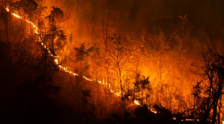
Wildfire
"An unplanned fire burning in natural or wildland areas such as forests, shrub lands, grasslands, or prairies." - FEMA
.jpg)
Winter Weather
"Consists of winter storm events in which the main types of precipitation are snow, sleet or freezing rain." - FEMA
Ready to Get Started?
Join industry leaders in making data-driven decisions about climate risk in real estate